Wetland Delineation Process Explained
What are Wetlands?
Coastal wetlands are directly adjacent to the ocean and include beaches, salt marshes, dunes, coastal banks, rocky intertidal shores, and barrier beaches. Inland wetlands are areas where water is at or just below the surface of the ground. Although these wetlands can appear dry during some seasons, they contain enough water to support certain plants and soils. Inland wetlands include marshes, wet meadows, bogs, and swamps. Wetlands that border on ponds, lakes, rivers, and streams are called bordering vegetated wetlands.
Why and How are Wetlands Protected?
Wetlands are part of our “common wealth.” They contribute to public health and safety, not only for you and your family, but for your community as well. Wetlands protect drinking water, prevent storm damage, and provide fish, shellfish, and wildlife habitats. Wetlands also support commercial fishing, tourism, recreation, and educational opportunities. These valuable resource areas are found in every community across Massachusetts and are an important part of a river’s watershed. Although most wetlands are found on private property – maybe even yours – their benefits are important to everyone. Landowners have an important role in protecting wetlands.

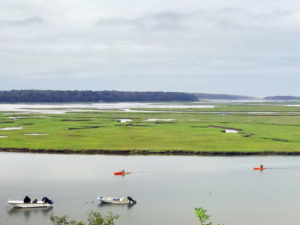
Hemenway Landing in Eastham, Massachusetts. Wetlands protect drinking water, prevent storm damage, and provide fish, shellfish, and wildlife habitats.
While we now recognize the many benefits of wetlands, that recognition has come late. Since Colonial times, almost one third of Massachusetts’ wetlands have been destroyed. Concerned about the loss of wetlands, Massachusetts adopted the nation’s first wetlands protection laws in the early 1960s. Today, wetlands are protected by both state and federal laws. In accordance with those laws, before any work can be done in 100-feet proximity to a wetlands area, the wetlands’ boundaries have to be delineated by a certified specialist. Even though the Department of Environmental Protection (DEP) develops maps of the state’s wetlands using aerial photography, the agency notes that the delineations developed in their inventory are photo interpreted and do not substitute for the delineation information required under the wetland regulations. Tighe & Bond can help determine how the regulations apply to your specific property.
Delineation Process
Our Wetlands Specialist delineates the edge of vegetated wetlands following the strict criteria prescribed by the DEP handbook. The delineation method includes multiple steps, and is a somewhat strenuous process, depending on the environment (which sometimes includes swamps, mosquitoes, and poison ivy). Let’s take a look at the delineation process in detail.
1. Examining the Vegetation

We look for certain species that are adapted for wetland conditions, such as the following inland wetland plants: Arrowhead, American Elm, Bladderwort, Black Spruce, Cinnamon fern, Pitcher Plant, Vervain, Wool-grass, and Winterberry.
2. Evaluating the Soil

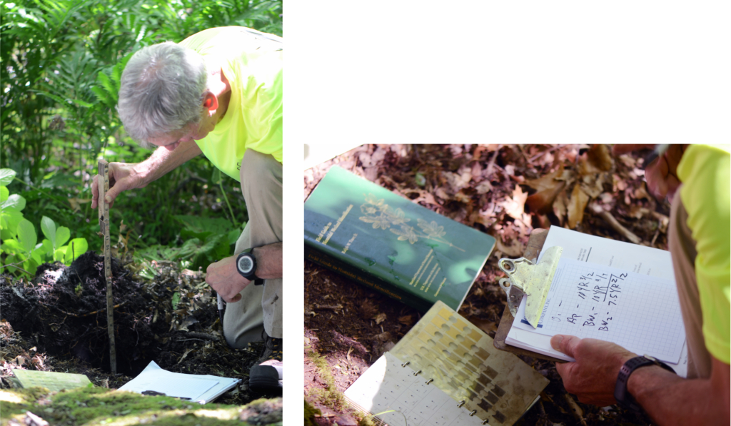
Once the approximate borders are established based on the vegetation growth pattern, it’s time to go deeper in order to get precise data. It’s important to get it right, because a few feet can make a difference in the permitting process and project costs for the property owner. We dig test holes to examine the underlying soils and look for soils that meet hydric conditions.
3. Marking the Edge of Wetland

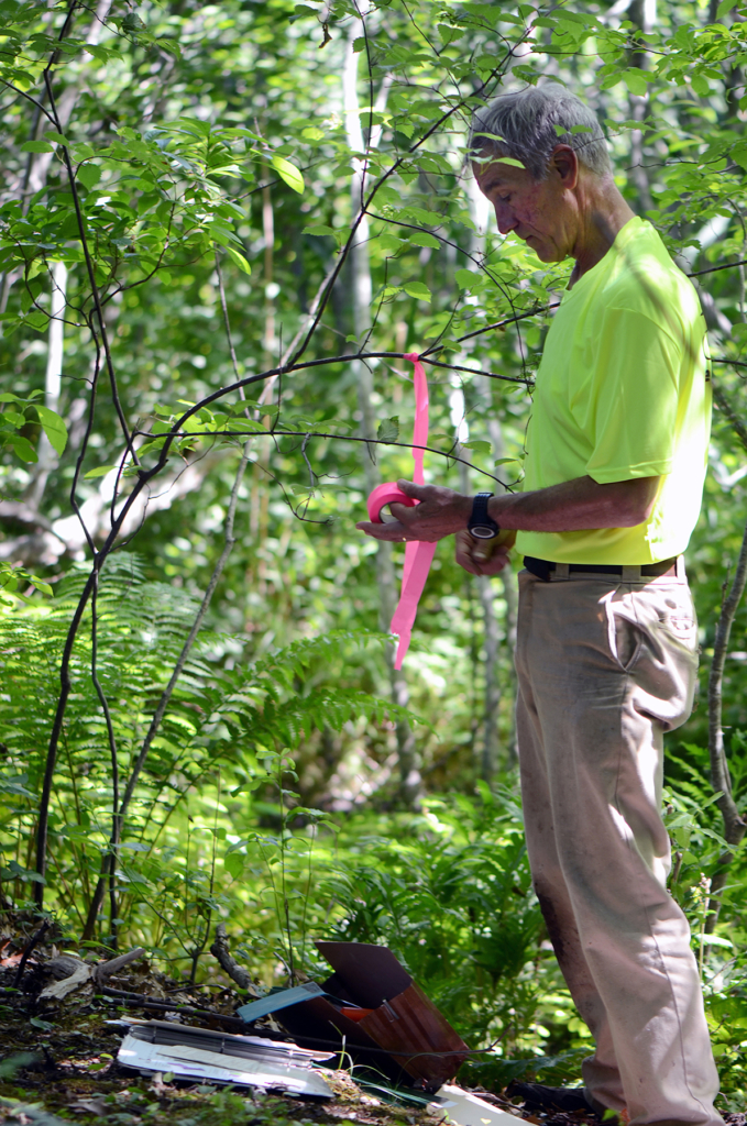
After we have considered the applicable indicators and identified the wetland edge, it’s time to mark it with numbered flags. Those bright flags are later located by a survey crew for inclusion onto the property’s site plan.
4. Preparing the Report

The Wetland Specialist prepares the required reporting form documenting the criteria and summarizing the onsite observations for filing with the local Conservation Commission.
Wetlands delineation helps preserve the valuable resource and has to be done for any project in 100-feet proximity to a wetland. Our specialists work in a team with surveyors and engineers and are available to help guide you through the survey, design, and permitting processes.


